Sunday, January 29, 2012

Fun in the Field: identify trees with dichotomous keys

I’ve been asked many times to recommend books on wildflower identification, usually “with lots of photos”.  But good comprehensive useable wildflower guides for the layperson are uncommon; in fact, there may not be any.  Even the best by necessity include only a subset of the flora; there always is the chance of finding something that isn’t in the book.  The diversity of the plant world is the issue.  While there are 800+ birds in the Golden Field Guide Birds of North America (north of Mexico), there are about 2600 plants in Wyoming alone, on the order of 6000 in California and 20,000+ in North America north of Mexico.
Andy's Mystery Plant.

Compounding the problem, characters for differentiating plant species tend to be small, or subtle to the human eye.  While photos may seem the best means of identification, often it is difficult to capture key features and range of variation with photographs.  There’s no getting around it -- plants can be tough to tell apart.

Los Osos Oaks on the Central Coast of California
(Quercus agrifolia, the coast live oak).
Tree identification, on the other hand, usually is a realistic goal for the layperson, at least in North America (but see NOTE at end of post).  There are far fewer species to consider, and many of the distinguishing features are easy to see.  Field guides to trees use several approaches to identification.  The Golden Field Guide Trees of North America (600 species) organizes trees by plant family, with illustrations and distinguishing features of each family provided at the beginning of the book.  After choosing a family, one browses that section making choices based on brief descriptions of diagnostic features, distribution maps and illustrations.  (Don't rule out this book based on lack of photos. Illustrations often are better at capturing diagnostic features of plants, counterintuitive though it may seem.)

The Audubon Society’s Field Guide to North American Trees, Western Region (300 species, including common naturalized ones), takes an approach that is a bit more involved, but probably more successful in the end if one is willing to invest the effort (isn't that always the case though?).  In the first part of the book, trees are grouped by leaf shape, or flower color, or fruit type. Photos are provided for each species to help with choice.  One then looks up the chosen species in the second part of the book, where there are descriptions, line drawings and distribution maps.  In the introductory section there are helpful drawings and definitions of important plant terms; becoming familier with these is a worthwhile time investment if one wants to get to know trees. 
Indian Paintbrush, State Flower of
Wyoming, is partially parasitic on
other plants, including sagebrush.

Then there are dichotomous keys.  The name alone is off-putting, and these keys can be overwhelming to a novice or layperson due to the unfamiliar botanical terminology.  Dichotomous keys are used extensively in professional manuals, though some online resources now offer more promising and intuitive approaches (see IdentifyLife for examples).  A dichotomous key leads the user through a series of choices, each with two alternatives.  Each step eliminates a group of plant species, finally arriving at the correct determination (usually).
Final steps in keying out the State Flower of Wyoming, the Indian Paintbrush.  From Dorn 2001.


But a dichotomous key can be a very useful tool, and does not have to be difficult.  Identifying plants with dichotomous keys is much easier to understand if one actually does it ... so let’s have some fun and identify a tree!
Mystery Tree, Laramie, WY
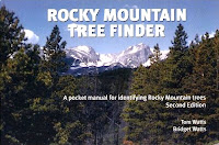
In North America, we're fortunate to have a relatively-simple tree flora (vs. the tropics ... oh my!) as well as a neat series of guides to tree identification -- the Tree Finders, for example the Rocky Mountain Tree Finder (RMTF).  These little books are easy-to-use dichotomous keys.  When I taught field botany at the University of Wyoming, the first day of class each summer included a field trip on campus identifying trees with our RMTFs.  I’ve used Tree Finders with kids too young to read the choices themselves.  They are a good introduction to dichotomous keys, they work well in many situations (but see NOTE at end of post) and they’re fun.  As a demonstration, let's identify the tree on the right.


The RMTF’s dichotomous key starts on page 10, where we are asked if this tree has “needles or scale-like leaves” OR “ordinary leaves”:


So what’s the answer? (check branch on left).  Did you say "needles or scales"?  That's correct, our tree does not have "ordinary leaves".  Very good!  Having chosen the first alternative, we now go to the Christmas-tree symbol at the bottom of the page.  Here we have to decide if there are needles OR if the leaves are scale-like.  Because our tree has needles (I hope you agree with my decision), we go to page 14 where at the bottom we see the needle symbol.


Here we have to decide whether the needles are bundled OR single (needles are single, see close-up below).
And so we proceed through a series of decisions, always with two alternatives (page with choices shown below after photos):

if you can easily twirl a needle between thumb and finger;
OR if you can’t twirl it because it’s flattened
Answer:  Ours are easy to twirl, I tried it.

needles are four-sided and leave little bumps on the twigs when they fall;
OR needles are round or oval in cross-section
Answer: Ours are the former, see bumps on twig below.

 ... it’s a SPRUCE!  but what kind?


if the needles are tipped with hard, sharp points, making the branches painful to squeeze;
OR if you can squeeze a branch without saying “ouch”
Answer: These needles clearly are sharp-pointed!

... it’s a COLORADO BLUE SPRUCE (Picea pungens) and we’re done!

The final page for our tree has a drawing and map, which we use to confirm that our determination is correct -- yep, looks right and its range includes the mountains of southeast Wyoming.  There also are life zones symbols -- the Colorado blue spruce grows in the montane and subalpine zones, as well as on the University of Wyoming campus.
Colorado blue spruce in front of Old Main, University of Wyoming, 2012.
Old Main was the first building of the University; photo ca 1908.
The Rocky Mountain Tree Finder is just one of a series of tree finders.  The Pacific Coast Tree Finder was my introduction to dichotomous keys.  I bought one several years before my first botany class, and was quite happy with it.  There are many “finders” by the Nature Study Guild, including guides to winter trees, desert trees, birds, tracks, ferns, intertidal life, constellations and several for flowers of various regions.  I’m skeptical about the last for reasons discussed in the beginning of the post, but I haven’t given them a try so can’t say for sure.  There’s little financial risk in testing a Finder as they are cheap -- generally $4.95 each.  To see the complete offering, visit Nature Study Guild Publishers.
The Pacific Coast Tree Finder, a real bargain at 75¢ (1973).

[NOTE:  Some groups of trees are tough to identify to species, for example the willows. Others are problematic in particular regions -- e.g. some the maples of New England, or oaks in southern Arizona.  In these cases you may still get close, down to a few species. Look at the distribution maps and life zone symbols for additional clues.]

Friday, January 27, 2012

Blog Crawl Gems

This Week's Treasures

SOPA, PIPA  An email message arrived from Wyoming Senator Mike Enzi -- he is dropping his cosponsorship of PIPA.  He thinks PIPA would have been fine of course, but is listening to the public.  Also, he’s glad that Senator Reid did what Senator McConnell told him to do (amazing how easy it is to spin things into one’s preferred view of the world).

The Atavism shared a poem by Brian Turner about the joy of biking, the start of a very nice post about the joy of natural history.  A watchful naturalist has the opportunity for all kinds of wonderful surprises when out and about, like a tiger beetle that requires halting a brutal hill-climb.  TA made mention of Beetles in the Bush, a blog with beautiful photos of beetles, other insects, arachnids and miscellaneous creatures of interest.  BiB features a recent well-illustrated post by Chris Brown about a beetle that mimics caterpillar poop! BiB author Ted C. MacRae shares his favorite photos from 2011 with anyone who wants to download them (I did ... nice batch of new wallpaper).  


Hopefully one of these days I will have learned enough about bugs to admire them for more than their beauty.  To right: unknown beetle on unknown Tertiary basaltic/volcanic rock, Wild Rivers Recreation Area, New Mexico (roughly 2 cm long).


At Small Things Considered, Merry writes about another amazing weblet of life -- Green Flypaper.  The nodes of this weblet are flies, spiders, yeasts and bacteria ... and maybe even an antimicrobial-producing microbe.  Can you connect the nodes?  Hint -- these are social spiders that produce huge complex sweet-smelling webs.

Babbage of the Economist blogs about digital textbooks.  This seems such a no-brainer, but some folks still think the expensive paper ones are better:  “To compare passages in a text, for instance, students often skip back and forth between them. And sometimes they need to have several books open at once.”  uhhh ... these folks need to try some online resources.  The most obvious advantage of digital textbooks that I see (beyond price) wasn’t mentioned in the post -- ease of updating as new information becomes available.  UPDATE -- Babbage put up a new post on technology in education -- digital textbooks and beyond, including gaming.

Twinkle twinkle little star ... have you wondered what they are?  Earth Picture of the Day provides a dazzling time-lapse “jiggled” photo of Sirius twinkling -- actually it’s “seeing cells” that cause the twinkle.  For more on twinkling, go here.  String players and parents of string players -- is Suzuki's “Twinkle Twinkle Little Star” playing in your head?  I found a classic example, complete with tape marking midpoint of bow and positions on fingerboard, and student very glad when the whole experience is over.
You might prefer “Twinkle Little Star”, a fine old-time fiddle tune played here by the great West Texas fiddler Homer Logan.

This week's Tip for Aging Baby Boomers comes from a paper published last week in Nature (article preview), and summarized in this week’s Economist.  Autophagy -- intracellular recycling -- is super important, so ramp up autophagy and get rid of those old mitochondria rife with free radicals.  The investigators found that autophagy increases with ... exercise!  How about that, here’s one of the mechanisms underlying the clear benefits of exercise.
GR courtesy FBNY.


Wednesday, January 25, 2012

Little Bone House on the Prairie

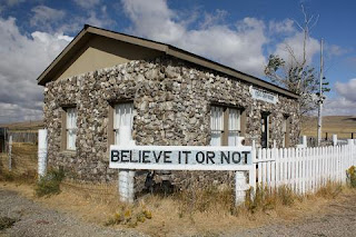
Fossil Cabin on Lincoln Highway, southeast Wyoming, USA.
In the northwest Laramie Basin, in the sagebrush grassland next to the old Lincoln Highway, is a little house made of bones -- dinosaur bones.  This is not as odd as it might seem, for dinosaur bones once were abundant here.  They were so common that when Samuel Williston visited the area in 1877, he reported fossilized bones beyond anything he had ever seen or heard of.  He persuaded his boss, the great Yale paleontologist Othneil Charles Marsh, to move their field crews from Colorado to Wyoming Territory.  Time proved Williston correct.  Many tons of fossilized bone went east into prominent museums, as well as into the little house in the sagebrush grassland.  Among the discoveries were 26 new dinosaur species and 45 new species of Jurassic mammals.   Though much of the bone is now gone, paleontologists still work the site, occasionally making new discoveries.
Fossil collecting in the olden days, southeast Wyoming.
Courtesy Stegosaurus On-Line.
The Formation
During the late Jurassic, ca 155 to 145 million years ago, the landscape in "southeast Wyoming" was very different from the sagebrush grasslands of today.  The supercontinent Laurasia had split in two, and North America was moving north through subtropical latitudes.  The environment was semi-arid, with lush vegetation in swampy lowlands and along rivers, dominated by conifers, ginkgos, cycads, tree ferns and horsetails.  The abundant dinosaurs probably lived in riparian zones and near wetlands.  Herbivorous sauropods were common -- quadrapedal giants with long necks and tails.  There were armored dinosaurs such as Stegosaurus, and bipedal carnivores such as Allosaurus.  Lungfishes, frogs, turtles, lizards, pterosaurs and early mammals were present as well.

This vast lowland, perhaps as much as 1.5 million sq km (600,000 sq mi) in extent, formed when precursors of the Rocky Mountains rose to the west.  Streams running off the uplands for some ten million years filled the basin with sands, silts and clays, mixed with the abundant bones of the residents.  The resulting sedimentary rocks eventually would be exposed with uplift of the Rocky Mountains -- the sandstones, siltstones, mudstones and fresh-water limestones of the “uniformly variable” Morrison Formation.  The Morrison often is easy to recognize, with its variegated outcrops ranging from light grey to greenish gray to red to almost purple.  Multiple beds are fossiliferous, some extremely and famously so.
Variegated beds of the Morrison.  Photo by Geotripper.
The Anticline
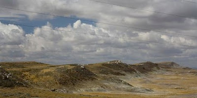
North of the bone house, the land slopes gradually up to a ridge crest several hundred feet above the highway.  This is Como Bluff, a small anticline at the northern edge of the Laramie Basin.  It was uplifted during the Laramide Orogeny, the mountain-building event that created much of the Rocky Mountains beginning about 80 million years ago.
Como Bluff anticline east of Medicine Bow.  Courtesy Google Earth, click to view.
The Como Bluff anticline is an east-west trending ridge about ten miles long that plunges to the west; the axis (crest) meets the Lincoln Highway four miles east of the town of Medicine Bow.  The anticline is highly asymmetric.  The south side dips gently southward, reflected in the gradual slope behind the house.  The uplift is bounded on the northwest by a high-angle reverse fault, with strata vertical to overturned in places.  The asymmetry has created a sandstone hogback with exposures of the Morrison Formation on the inner face -- the backside of the ridge above the house.  These are the actual bluffs of Como Bluff.
Como Bluff cross section showing hogback sloping to south and Morrison exposed
on inner face.  Maximum vertical relief ca 400 ft; horizontal distance ca 4 mi.
From Mears et al. 1986, after data in Dunbar 1942.
The Discovery
In 1876, Como Bluff was the site of one of the biggest fossil finds in North America.  The original discovery was made by William Harlow Reed and William Edwards Carlin, station agent and station foreman at the Union Pacific Railroad’s Como Station in Wyoming Territory.  Many locals were aware of the abundant fossilized bones, but apparently Reed and Carlin knew enough to recognize their importance.  They even identified some to species -- Megatherum, a giant ice age sloth.  Reed and Carlin wrote a letter to Professor Marsh describing their finds; several months later Marsh received a package containing a shoulder blade and vertebra from the giant sloth.  He immediately recognized both the true identity of the bones (the sauropod Brontosaurus) and the value of the material.  It was at that point that he directed his field assistant Williston to make a trip to Wyoming Territory to assess the merit of the site.  The story from there has been told many times -- of the Dinosaur Graveyard, the Bone Wars and the two opposing gladiators, Othneil Charles Marsh and Edward Drinker Cope (several accounts listed at end of post).

Stegosaurus cast, Geology Museum, University of Wyoming.  From specimen
at the American Museum of Natural History, found near Como Bluff in1994.
Reed and Carlin continued as employees of the Union Pacific, but also worked on Marsh’s field crews.  Carlin switched sides, going to work for Cope before giving up the fossil business altogether.  Reed stayed with Marsh, eventually becoming a full time fossil collector.  He went on to work for prominent institutions such as the Carnegie Museum of Natural History and the American Museum of Natural History.  Reed was appointed Curator of the Geological Museum and Geology Instructor at the University of Wyoming, where he stayed until his death in 1915.
W.H. Reed in the Bone Room, early 1900s.  Miscellaneous AHC
Collections.  American Heritage Center, University of Wyoming.
Used with permission.
The House
By 1932, a steady stream of travelers was crossing Wyoming on the Lincoln Highway.  Popular stops in the eastern part of the state included the old Texas Trail in Pine Bluffs, the historic Union Pacific Railroad Depot in Cheyenne, the University Museum in Laramie and the Virginian Hotel in Medicine Bow.  East of Medicine Bow, homesteader Thomas Boylan had been gathering bones at Como Bluff, planning to reconstruct dinosaur skeletons along the highway as a tourist attraction.  But a specialist from the University of Wyoming quashed the plans when he explained that the 5796 bones were such a mix of species that there was no hope of putting together even a single dinosaur.  Instead Boylan built a house by the side of the road, a dinosaur museum called the Fossil Cabin.
Como Bluff Museum postcard, 1938.  Ludwig-Svenson Studio
Collection.  American Heritage Center, University of Wyoming.
Used with permission
Boylan and his wife, Grayce, did a booming business with their museum and service station, especially after Ripley’s Believe It or Not featured the “Oldest House in the World” in newspapers around the country in 1938.  Their business thrived even during the Depression and World War II.  The Lincoln Highway was the main east-west thoroughfare across the United States, and traffic increased steadily through the 1960s.
Lincoln Highway, from "Historic Motor Convoy Treks the Lincoln Highway."
No source given.
Then in 1970, Interstate Highway 80 between Laramie and Rawlins was completed, turning the Lincoln Highway into a back road.  Tourist business dropped off dramatically, and Grayce Boylan finally sold the cabin in 1974.  The new owners continued to operate the museum until 1992.  As of 2011, the museum was closed and the property for sale.  [For status updates, check with the town of Medicine Bow.]

Visiting Como Bluff and the little bone house on the prairie
Photo from wyominghistory.com.
When the weather is fine, the old Lincoln Highway (US 30) provides a peaceful and scenic alternative to Interstate 80 between Laramie and Rawlins. Como Bluff and the Fossil Cabin are north of the highway about 13 miles northwest of Rock River and 5 miles east of Medicine Bow.  Although the museum is closed, visitors are welcome to inspect the building from the outside.

The Morrison Formation lies just over the hill to the north, but is not accessible from the cabin due to private ownership.  For views of the famous outcrops, take Albany County Road 610, the Marshall Road, north from US 30.  This turnoff is about 9 miles east of Medicine Bow and 5 miles west of Rock River, marked by a sign for the Como Bluff Fish Hatchery.  Follow the gravel road north about 7 miles to where it drops into a small valley; the bluffs and distinctive Morrison Formation can be viewed west and east of the road (private ownership, stay on road).
The Morrison Formation exposed on the inner face of the hogback at Como Bluff.
Looking westerly.  Photo by Tom Rhea.
More information about Como Bluff and the Fossil Cabin can found at these websites:


This is my contribution to Accretionary Wedge #42.


Sources

American Heritage Center, University of Wyoming, Online Collections (used with permission).

Breithaupt, B.H.  ca. 1993.  Como Bluff : the dinosaur graveyard.  Laramie, WY: Geological Museum, Dept. of Geology and Geophysics, University of Wyoming.

Breithaupt, B.H.  1991.  Stop #1 - Como Bluff. in Sundell, Kent A., and Thomas C. Anderson. Road log volume for Rediscover the Rockies: AAPG-SEPM-EMD Rocky Mountain Section meeting, 1992.  Casper, WY: Wyoming Geological Association.

Dunbar, R. O.  1942.  The geology of Como Bluff anticline, Albany-Carbon counties, Wyoming. Thesis (M.A.)--University of Wyoming.

Mears, B., Jr., Eckerle, W.P., Gilmer, D.R., Gubbels, T.L. Huckleberry, G.A., Marriott, H.J., Schmidt, K.J., and Yose, L.A.  1986.  A geologic tour of Wyoming from Laramie to Lander, Jackson and Rock Springs.  Public Information Circular No. 27.  Laramie, WY: Wyoming Geologic Survey.


About the Bone Wars:

Schuchert, C., and LeVene, C.M. 1940. O.C.Marsh, Pioneer in Paleontology. Yale University Press, New Haven.

Shur, E. 1974. The Fossil Feud. Exposition Press, NY.

Ostrom, J,H., and McIntosh, J.S. 1966. Marsh's Dinosaurs: The Collections from Como Bluff. Yale University Press, New Haven.


Saturday, January 21, 2012

Topographic reversal, then and now

The southern Laramie Basin, Wyoming, USA.  Click to view prominent geomorphic features.
Crossing the southern Laramie Basin are elongate mesa-like surfaces that stand as much as 500 ft (150 m) above the Laramie River.  They are capped with water-worn gravels and cobbles derived from formations in the Medicine Bow Mountains to the west, with fragment size decreasing from west to east.
 Above, cobbles on the Eagle Rock surface.
Below, closer view with penny for scale.
These surfaces are the remains of old drainage bottoms of the Laramie River and its tributaries.  Why are former lowlands now standing above everything else?  Because the rest of the old landscape is missing, removed by several-million-years-worth of erosion.  The coarser deposits of the old drainage bottoms provided protective caps while surrounding softer Mesozoic rocks were worn away.  This differential erosion has produced topographic reversal or inversion.
Southern Laramie Basin showing Pleistocene terraces, benches and deflation features.
View looking west.  Mears 1984; illustration by Anne C. Mears.
The most prominent of the surfaces is the Airport surface, which consists of two arms that join at the Laramie Airport.  The north arm extends 17 miles west to the valley of the Little Laramie River; this is the route of US Highway 130, the Snowy Range Road.  The surface drops 270 ft (80 m) in elevation from west to east, with the gradient decreasing from 60 ft/mi to 20 ft/mi en route.
Two arms of Airport Surface join at Brees Field; Big Hollow in between.  Click to view.
Excavation of the Laramie Basin is attributed largely to wind (deflation), in part because aeolian features are so abundant.  Between the the two arms of the Airport surface lies the Big Hollow, one of the largest deflation depressions in the United States.  It is roughy eleven miles in length, up to four miles across and as much as 200 feet deep (18 km by 4 km; to 60 m deep).  No evidence of faulting or subsidence has been found.  Deflation mainly during cold dry Pleistocene times is the generally-accepted explanation, probably aided by periglacial weathering.
Looking east towards the Laramie Range from the Eagle Rocks surface.  The Big Hollow
is just beyond in the midground; the Airport surface forms the north rim of the Hollow.
Plains lakes and salt pans in Laramie Basin (click to view).

Smaller deflation hollows are common in the southern Laramie Basin; some are younger Holocene features that are still growing.  Many are occupied by lakes with no external drainage, and salt pans have developed with seasonal evaporation. Aeolian deposits of salt often occur downwind of the lakes, marked by halophytic (salt-tolerant) vegetation.


The Pleistocene may be over, but aeolian processes are still with us.  We've had day after day of “strong winds” with average speeds of 35 to 45 mph and gusts to 50, 60 and even 80. Topographic reversal is happening!  Most of the snow has blown away, leaving relic features that were protected from deflation by compaction.  Depressions made by feet and tires now "stand high" above the dirt and asphalt.
Snow deflated from dirt road, except for bike tracks
protected by compaction.  Original depressions
still visible in snow patch in foreground. 


Topographic reversal leaves artwork on street.

Sources

Knight, S.H.  1990.  Illustrated geologic history of the Medicine Bow Mountains and adjacent areas, Wyoming. Memoir 4.  Laramie:  Geological Survey of Wyoming.

Mears, B., Jr.  1987.  Late Pleistocene periglacial wedges sites in Wyoming; an illustrated compendium. Memoir 3.  Laramie:  Geological Survey of Wyoming.

Mears, B., Jr.  1984.  Advanced Geomorphology seminar, University of Wyoming; field trip and class notes.

Aerial photos courtesy ArcGIS online.


Thursday, January 19, 2012

Blog Crawl Gems

This Week's Treasures


On the subject of internet freedom -- SOPA and PIPA are losing sponsors.  Three more had dropped out as of 10 am PT Jan 18.  But that’s only 3 of 31!  (Map of SOPA sponsors by state)  You can easily email these folks as well as your own legislators at websites for the Senate and House. Some Senate websites were experiencing technical difficulties today ... hmmm, too much traffic?  Another option is to sign Google's online petition.  As of 4:30 pm ET Jan 18 there were 4.5 million signatories.


For something more relaxing -- Looking for Detachment provides a series of virtual visits to Spencer Hot Springs in Nevada:  then, and now a bit more civilized (for better or for worse?).  On the left is the remains of a photo from waayy back, early 1980s at the latest. The memorable bath house is now gone.


Have a look at the incredible blue color of sodalite, courtesy Sandatlas.  I find it so beautiful that it is almost intoxicating.  Is it possible to have pleasure receptors sensitive to a specific wavelength of light?

Courtesy USGS Tapestry.
earth-literally is posting material from his course on Basin Analysis ... very cool!  thanks, e-l.  He starts with introductory material:  “Introduction and genetic basin classification; Heat flow and the geotherm; isostasy. Introduction to stretching.” Week 2 features “More of lithospheric stretching, including passive margins”.  For me, the material ranges from very informative to incomprehensible, with the latter not standing in the way of learning quite a lot about basins.  I look forward to intermontane basins (my home), and hopefully metamorphic core complexes (vacationing in Basin and Range country this spring).

CHIMERAS writes about promising gene therapy to deal with the mutation behind Duchenne's muscular dystrophy in “Introns, exons, and stop codons: how antisense oligonucleotides can fix frameshift mutations”.  Not only is it good news, it is a really cool mechanism --  a molecular “bandage” that covers up the error so that the resulting messenger RNA works as it is supposed to ... to direct synthesis of the protein dystrophin, critical to muscle function.


I have an amazing friend who pedals across large stretches of the US each summer for JettRide, leading packs of teens on bikes to raise money to fight Duchenne's muscular dystrophy.  Go Melissa!!


Mention of proteomics generally makes me sigh and drift off, but at Small Things Considered I found a very understandable and interesting (i.e. well-written) post about the thermodynamics of proteins in the human body:  "Pushing the Thermodynamic Envelope into the Proteomic Edge."  We indeed are living on the edge, “just a few kcal mol-1 away from being a pile of unfolded proteins”, a melted mass of mush.

Finally, here’s a much lighter side of molecular biology -- protein synthesis a la The Sixties, portrayed in “a dynamic and joyful way”.  Actually it was 1971 at Stanford University.  Paul Berg (Nobel Prize 1980) starts with a short lecture, explaining that “Only rarely is there an opportunity to participate in a molecular happening.  You are going to have that opportunity”  His talk is followed by Stanford students dancing on a grassy field -- messenger RNAs, ribosomal RNAs, transfer RNAs, initiation factors and amino acids all joyfully cavorting in the California sunshine.  Berg later said that when he saw the entire film, he was taken aback by how dry and academic his performance was ... especially compared to what followed :)